 Radnor High School
Radnor High School
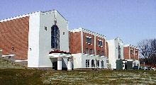
RAC practices and hosts meets in the Radnor High School Pool. The pool and supporting areas were newly rennovated in 1997, as part of a major High School rennovation project. Radnor High School is located in Radnor Township, Pennsylvania, between the communities of Villanova and Wayne. It is adjacent to the Lancaser Ave (US 30) interchange of I-476 ("Blue Rt."). Exit I-476 at US 30 (Lancaster Ave). Turn left at the bottom of the highway ramp onto Lancaster Ave. Travel less than 1/2 mile to Radnor-Chester Road (Traffic Light). Turn right. Rear entrance to the high school is the first possible right turn from Radnor-Chester Road. Pool entrance is adjacent to the football stadium.
Click here for an off-site map of the area.(Use Your Browser's "Back Button" to Return)
Southern Division Teams
Lower Merion High School
(645-1810)- Take Montgomery Ave east into Ardmore, Lower Merion High School
is on the left. Parking is in the rear of the school, at the end of Owen Rd
(10-15 min)
Upper Merion High School (337-6032)- Take King of Prussia Road to the end (Croton Rd). Turn right on Croton and continue to South Gulph Rd. Bear right onto South Gulph and continue to Henderson Rd. Turn left on Henderson and continue north, crossing rt 202. Turn left onto Prince Frederick (just past the Queen Village Shopping Center). Stay on Prince Frederick for approx 0.3 miles to Stonybrook Lane. Turn left on Stonybrook, which dead ends at the high school (approx 15-20 min)
Plymouth-Whitemarsh High School (825-1500)- Take I-476 (Blue Rt) North to Germantown Pike East (Rt 422 East). Take 422 east approx 3/4 mile (you will pass Butler Pike). The school is on the left. Entrance is Colonial Drive (appox 15-20 min).
Abington High School: Take PA turnpike east (I-276) to exit 26 (Fort Washington). Follow signs for Route 309 South. Stay on 309 South until you come to Greenwood Ave. Greenwood is the first traffic light after the Easton Rd exit off of 309. Turn left on Greenwood and go to the first light. At the light, bear left onto Rices Mill Rd. Pass Cheltenham High School and continue on Rices Mill, crossing over Rt. 73, Glenside Ave, and Jenkintown Rd. (after Glenside Ave, Rices Mill turns into Highland Ave). The High School is on the left just past Jenkintown Ave. (approx. 45-60 min)
Springfield High School: PA turnpike east to Exit 26 (Ambler). From tollbooth follow signs for Rt 309 south. Stay on Rt 309 south for 2.2 miles to the Paper Mill Rd exit. As you proceed down the exit ramp, you will see Springfield High School on your right. Turn at the bottom of the ramp and take your first right into the high school.
Other Opponents, Trophy Meet Sites, Championship Sites
Perkiomen
Valley High School (Collegeville): Take King of Prussia Road to the end
(Croton Rd). Turn right on Croton, left on Brooks Rd and left on S Gulph (this
takes you to K of P mall). Turn left on 202 south (DeKalb Pike), follow signs
onto Rt. 422 West. Take Collegeville exit from 422, go right onto Rt. 29N
(Collegeville Road). Continue on Rt. 29N through Collegeville, approximately 4.5
- 5 miles to PVHS on left. (35 minutes)
Lower Moreland High
School: PA Turnpike East to Exit 27 (Willow Grove). Route 611 South to
Welsh Rd (may be called "Old Welsh"; Landmarks at this intersection are a church
on right, funeral home on left). Left on Welsh(or "Old Welsh"). Welsh Rd becomes
Route 63. Continue across 232 (Coastal gas station on left, shopping
center on right). After crossing Rt 232,Welsh Rd becomes Philmont
Ave. Philmont Ave to Red Lion Rd. High School and pool are at the
top of the hill on your right (Approx 45-60 minutes)
OR
Take I-76 east to
the Roosevelt Expressway (Rt 1) North. Rt 1 north to Red Lion Rd (Route
63). Turn left on Red Lion Rd. Travel approx. 2 miles on Red Lion
(cross over Philmont Ave). High school and pool are on Red Lion Rd on the
right. (Approx 45-60 min)
Cheltenham High School: Take PA turnpike east (I-276) to exit 26 (Fort Washington). Follow signs for Route 309 South. Stay on 309 South until you come to Greenwood Ave. Greenwood is the first traffic light after the Easton Rd exit off of 309. Turn left on Greenwood and go to the first light. At the light, bear left onto Rices Mill Rd. Stay on Rices Mill until you come to Panther Ave. Turn left on Panther, the school is on the left. (approx 45-60 min)
Wissahickon High School: PA turnpike east to exit 26 (Ft Washington). Follow signs for 309 North. Take 309 north to the Springhouse Rd exit. Turn left onto Norristown Rd. Take Norristown Rd to Bethlehem Pike and turn left. Go to the second light and turn right onto Drager Rd (BMW dealer on the corner). The first left is the road that the high school is on. The pool is attached to the Middle School (across the street from the High School).
Council Rock High School: PA Turnpike east 17 miles to US 1 (Exit 28). Go left at the fork in the ramp. Take US 1 North to PA 413 Exit (Right hand exit). To follow 413 North, as you come off the highway, make a quick right and then a left at a flashing light; 413 then takes you through Langhorne and on to Newtown. You will pass St Mary's Hospital on the right and George School on the left. When you come to the light at the Newtown Bypass, continue to follow the signs for 413 North (they will direct you to turn left at that light). You will see Tyler Park on the left. Following the traffic light at Newtown pass you go through two more lights, and then before the third light take the slip road rd to the right. You will then see Council Rock High School on the left. Pool is in the back.
Norristown High School (Harvest Meet): 202 North (stay to left to avoid Bridgeport) to Main Street (Norristown). Turn left. Main Street to N. Whitehall Rd, turn right. N. Whitehall to Eagle Dr., turn left. High School is on Eagel Dr.
William Tenent High School (Odd-Age Meet: Centennial): Turnpike east to Willow Grove exit. Take 611 North past the Naval Air Station to Rte 132 (Street Rd). Turn right on Street Rd, go past a second airfield. Just past the airfield, look for Centennial Rd. Turn right on Centennial Rd, high school is on the left.
LaSalle University (League ("A") Championships): I-76 east to the Roosevelt Expressway (Rt 1) North. Rt 1 north to Broad Street (Route 611) North. Travel north on Broad Street approximately 1.3 miles to Olney Ave. Turn Left on Olney Ave. Travel 3-4 blocks to 20th St. The Joseph Kirk Memorial Natatorium is in Hayman Hall at the corner of 20th St & Olney Ave. (approx 35 minutes)